Introduction
Energy is not only a question of carbon, cost, or technology… It’s also about space and time. Each electricity source mobilizes a portion of territory, sometimes visible, sometimes diffuse, over periods that vary greatly between construction, operation, and remediation. These spatiotemporal differences deeply influence the planning, acceptance, and sustainability of our energy choices.
(LinkedIn: https://www.linkedin.com/pulse/what-footprint-our-electricity-sources-benoit-marcoux-qtbwe/)
Overview
The table below (the full version can be found in the appendix) compares land occupation by generation technology, highlighting the differences in the nature and duration of this occupation. These can be permanent or temporary, exclusive or shared, extractive or reversible.
(Where possible, data and assumptions are based on Québec’s geographic and technical context.)
Summary table — land-use footprint by technology (ha/TWh/year)

Units: hectares per TWh of electricity delivered annually (ha/TWh/year). The figures include transmission rights-of-way, supply chains, and, where applicable, a co-use credit. The full table is presented in the annex. Details of the underlying assumptions are available upon request. One hectare is equivalent to approximately 108,000 sq. ft. or 2.5 acres.
Reservoir hydro has a very large spatiotemporal footprint, but it is very useful because its power is dispatchable, unlike nuclear or run-of-the-river hydro, which operates continuously. Solar and wind remain intermittent, but in Québec the large reservoirs facilitate their integration: the solar electricity produced in the summer makes it possible to keep the water for winter peaks.
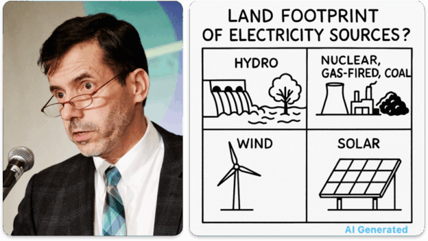
These tables show how land occupation differs across electricity sources, and more importantly, how the type and duration of that occupation vary. Large hydroelectric reservoirs and fossil-based systems dominate in both total surface and duration, but their land use is neither as intensive nor as reversible as that of newer technologies.
Methodology
The method to derive these tables follows a progressive approach:
- Start from the direct footprint—the physical surface occupied by production infrastructure, then three adjustments are applied to obtain the adjusted footprint.
- Add the supply chain and electricity transmission extensions, which represent the upstream and downstream portions of the energy cycle.
- Subtract co-use (agricultural, recreational, ecological) to account for shared land.
- Adjust for duration of occupation to obtain a net spatiotemporal measure, expressed in hectares per TWh of energy delivered per year.
This method allows an apples-to-apples comparison between technologies with vastly different scales—from a local solar array to a continental hydroelectric complex.
Direct footprint
The direct footprint refers to the physical area occupied by a power plant or generation site. It is the starting point for any comparison, since it reflects the portion of land directly dedicated to energy production—the core site and its project-related zone.
In addition to the core, the direct footprint includes the peripheral areas required for operation or safety. It varies widely across technologies:
- For nuclear power, it includes the exclusion and emergency planning zones, which can extend several kilometres around the site.
- For coal or gas plants, it includes safety buffers, cooling ponds, and adjacent industrial zones.
- For hydroelectricity, it encompasses dams and reservoirs, often permanently flooded.
- For wind, it covers turbine spacing and access roads.
- For solar, service roads and buffer zones for large solar parks or roof space.
These peripheral areas significantly enlarge the apparent footprint of a project, even if not all land is exclusively occupied. They must, therefore, be considered as an essential component of the direct footprint.
Variation across technologies:
- Large hydroelectric projects flood thousands of square kilometres, permanently transforming the landscape.
- Thermal and nuclear plants have compact sites concentrated around buildings and security areas.
- Wind and solar farms spread over large surfaces, but their physical occupation is low—a small fraction of the ground is built upon.
Three adjustments to the direct footprint
Three key factors refine the direct footprint:
1. Supply chain and transmission — spatial extensions
The real footprint of a technology goes far beyond its generation site. Upstream, it includes material extraction and processing zones; downstream, the transmission networks delivering power to load centres.
This effect is especially significant for Québec’s reservoir-based hydro: 315–735 kV transmission lines can extend hundreds of km, even over 1,500 km, linking northern generating stations to southern demand centres. By contrast, other technologies—solar, wind, thermal—can often be located closer to load centres, even co-located with them.
For fossil and nuclear power, supply chains (mines, pipelines, processing plants) often dominate total footprint, whereas for distributed renewables this contribution is marginal.
2. Co-use — a spatial credit
Co-use applies, to varying degrees, across all technologies.
- For onshore wind and vertical bifacial solar, over 80% of the land remains available for agriculture, forestry, or conservation.
- For run-of-river hydro, riverbanks and water bodies can be used for navigation, fishing, or recreation.
- Thermal and nuclear plants, though more contained, may be surrounded by conservation zones or environmental monitoring areas.
- Even hydro reservoirs, though permanent, offer recreational co-use.
- In contrast, rooftop solar, while excellent for co-use, remains a real but limited potential, mainly due to the available surface area, geometry and orientation of the roofs. Even if fully mobilized, it can only cover a relatively modest part of the provincial demand.
Co-use, therefore, acts as a spatial credit that reduces the effective footprint of a sector by promoting the integration of other functions in the same territory. It thus becomes an indicator of territorial compatibility between energy and other socio-economic functions.
3. Temporal dimension — prolonged occupation
Finally, the duration of occupation—from construction through remediation—directly affects the true intensity of land use.
Long-cycle technologies (hydro, nuclear, fossil) tie up land for decades or permanently, while renewables like solar and wind have shorter, reversible cycles.
- Construction of a dam or thermal plant can take many years, even a decade, while a solar or wind farm can be built in less than two.
- At the end of life, fossil and nuclear sites require decades of decommissioning and monitoring, whereas wind or solar facilities can be dismantled or repowered within months.
- These three adjustments—supply chain, co-use, and temporality—broaden the concept of land footprint from a raw surface area to a net spatiotemporal occupation.
Hydroelectricity and social acceptability
Hydroelectricity, the cornerstone of Québec’s energy system, stands out for its stability and historical landscape integration, but its reservoirs represent a permanent transformation of land—a legacy that cannot be undone. This model has long enjoyed social acceptance in southern Québec, where hydro is seen as a symbol of modernity and energy sovereignty. However, this is not the case for many northern Indigenous Nations, for whom these projects caused deep territorial and cultural losses and continue to raise issues of recognition, governance, and benefit-sharing.
Vertical co-use: the Beauharnois case
The Beauharnois generating station’s intake canal illustrates how existing infrastructure can serve multiple purposes. This artificial canal, about 25 km long and nearly one kilometre wide (?2,500 ha of water surface), is also part of the St. Lawrence Seaway, serving commercial navigation and water-level regulation. This dual role makes it a striking example of hydraulic and logistical co-use. The same canal could host floating solar panels (floating PV) without impeding hydraulic function or navigation. At a realistic density of 0.5 MW/ha, it could accommodate about 1.2 GW of panels generating 1.5–1.8 TWh per year—nearly 15% of Beauharnois’s current output (11.7 TWh). Such integration would boost production without any new land footprint—a model of technological co-use on already developed territory.
Challenges and perspectives
Land-use analysis highlights three key insights:
- The importance of transmission and supply: the farther a source is from load centres, the more significant the land footprint associated with transmission lines becomes. For fossil-fuelled power plants, supply networks (e.g. gas pipelines) must also be considered, which, like the Beauharnois Canal for the St. Lawrence Seaway, represent a substantial portion of the actual spatial footprint of the energy system.
- The value of co-use: what matters is not total surface but the project’s ability to share space with other functions.
- Reversibility and remediation: newer technologies—wind, solar, storage—stand out for their capacity to release or repurpose land after decommissioning.
Conversely, fossil and nuclear systems leave lasting marks:
- Coal mines and ash ponds require decades of environmental monitoring.
- Gas wells and pipelines must be sealed and monitored long-term to prevent methane leaks.
- Nuclear plants require decades of decommissioning, and waste storage sites remain restricted for generations.
This temporal difference in land occupation — the time during which territory remains effectively committed even after a power plant stops producing — is just as significant as the surface area itself.
Taken together, these elements suggest that, in the long term, the real advantage of wind and solar technologies lies not only in their low emissions, but also in their qualitative spatiotemporal footprint: co-usable, reversible, and limited in duration.
Conclusion
The land footprint of electricity systems is more than a measure of hectares. It tells the story of our collective relationship with territory: what we choose to transform, share, or preserve to produce the energy we rely on.
In Québec, this spatiotemporal perspective reminds us of three simple truths:
- Our hydroelectric heritage shaped both landscapes and mindsets, but it alone cannot meet future demand.
- New renewable sources—solar, wind, and storage—do not threaten the land; they invite it to become multifunctional: economic, agricultural, energy, and ecological at once.
- Proximity, reversibility, and temporality should count as much as installed capacity in planning criteria.
Reducing carbon emissions will not be enough; we must also reduce the duration and intensity of our land footprint. Technologies capable of coexisting, adapting, and disappearing without a trace are those that will build a truly sustainable energy future.
Annex — Detailed Land-Use Table by Generation Technology (ha/TWh/year)

Units: hectares per TWh of electricity delivered annually (ha/TWh/year). The figures include transmission rights-of-way, supply chains, and, where applicable, a co-use credit.
Column Definitions
Core (direct footprint)
The land area strictly occupied by physical production infrastructure: the plant, panels, turbines, platforms, access roads, and substations.
Project-related area
The peripheral land required for safety, access, operational spacing, or technical constraints—for example, nuclear exclusion zones, solar buffer areas, or turbine spacing in wind farms.
Transmission ? southern Québec
The land footprint associated with transmission corridors needed to bring electricity from production sites (often in the North) to load centres in southern Québec: 735-kV and 315-kV corridors, rights-of-way, and substations.
Supply chain
Indirect land use linked to the extraction, processing, transportation, and logistics of materials or fuels: mines, pipelines, processing plants, terminals, quarries—depending on the technology.
Footprint before co-use
The sum of the core footprint, project-related area, transmission, and supply chain — before accounting for areas that can be shared with other land uses.
Spatial co-use (credit)
The portion of the project-related area that can be simultaneously used for other functions (agriculture, forestry, navigation, recreation). A higher co-use credit reduces the effective land footprint.
Adjusted spatial footprint
The net land area effectively monopolized by the energy source after subtracting the co-use credit. Expressed per TWh/year.
Temporal coefficient
The ratio of total land occupation time (construction + production + remediation) to productive time. It reflects how long land remains occupied even when no electricity is being produced.
Spatiotemporal footprint
The adjusted spatial footprint multiplied by the temporal coefficient.
It is the most complete measure, capturing the total land occupation over the full life cycle for each TWh of electricity produced.